Geography
Our Intent
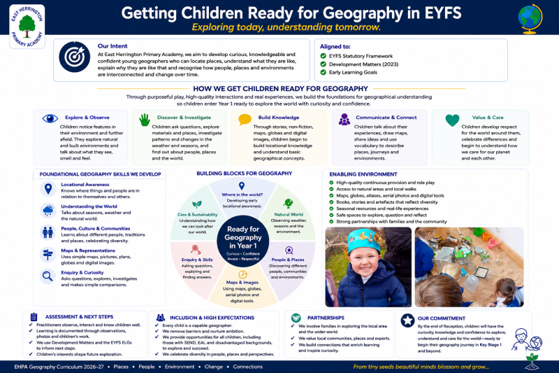
At East Herrington Primary Academy, we aim to develop curious, knowledgeable and confident young geographers who can locate places, understand what they are like, explain why they are like that and recognise how people, places and environments are interconnected and change over time.
- build, retrieve and apply secure locational and place knowledge and knowledge of physical and human processes;
- develop disciplinary knowledge through geographical enquiry, fieldwork, mapping, GIS, observation, measurement, data interpretation and evidence-informed conclusions;
- develop increasingly secure mental maps of the locality, the United Kingdom and the wider world;
- use the concepts of place, space, scale, location, interconnection, process, environment, sustainability and change;
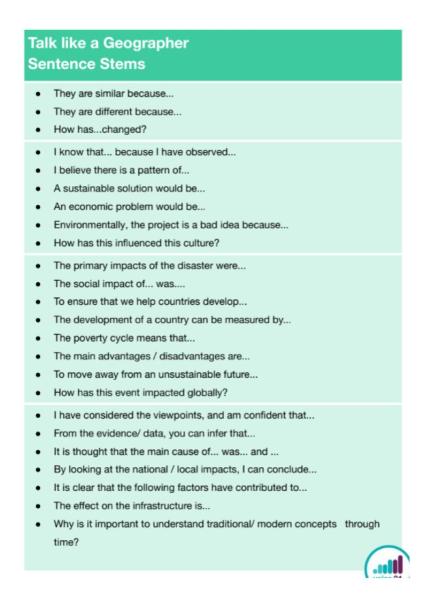
- use increasingly precise geographical vocabulary, maps, atlases, globes, aerial/satellite imagery, OS maps, digital mapping and geographical data;
- understand meaningful climate and sustainability issues through geographical evidence and different perspectives; and
- recognise how geography connects to careers, employers, workplaces and the green economy.
Our Implementation
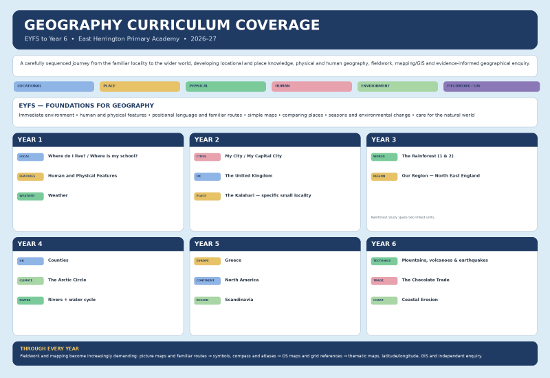
The curriculum is carefully sequenced from EYFS to Year 6. Existing units and learning sequences are deliberately ordered so that new knowledge builds on secure prior learning. Each unit identifies prior learning and a ‘Why This? Why Now?’ rationale, making clear why content is positioned at that point and what later geographical learning it prepares pupils for.
- retrieval of relevant locational, place, process and vocabulary knowledge;
- explicit teaching and modelling of geographical concepts, vocabulary, maps and representations;
- purposeful use of maps, atlases, globes, aerial/satellite images, OS maps and digital mapping/GIS;
- geographical enquiry through questions, observation, fieldwork, measurement, data collection and comparison;
- opportunities to identify patterns, relationships, similarities, differences and interconnections at different scales; and
- reasoning and evidence-informed conclusions, with misconceptions addressed promptly.
Teachers follow the published curriculum sequence while responding to pupils’ starting points. Fieldwork, mapping and data activity are selected because they deepen geographical understanding.
The Impact
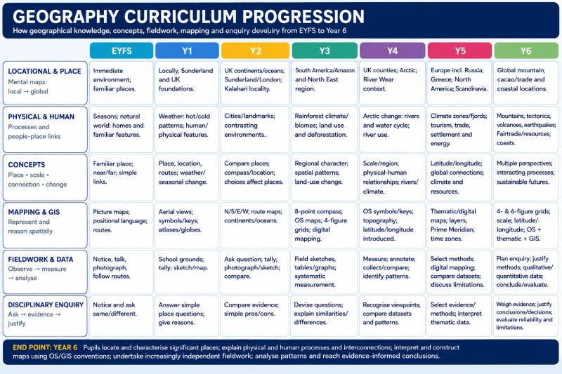
By Year 6, pupils have an increasingly secure mental map of the UK and wider world and can locate and characterise significant places at a range of scales.They explain key physical and human processes and the interconnections between people, places and environments using precise geographical vocabulary. Pupils interpret and construct maps, use OS conventions and grid references, use digital mapping/GIS, and undertake increasingly independent fieldwork. They collect, present and interpret geographical information, identify patterns and relationships, compare places and reach justified conclusions using evidence. Pupils understand meaningful climate and sustainability issues through geographical evidence, appreciate diverse places and perspectives, and recognise careers in which geographical knowledge and green skills are valuable.
Files to Download